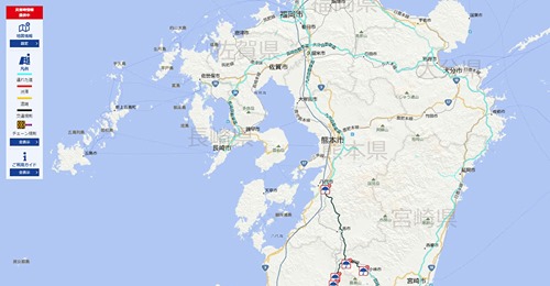
Toyota Provides an Easy-to-use Map Showing Real-time Traffic Information and Road Closures in Japan
被災地へのアクセスを「トヨタ 通れた道マップ」で!
東日本大震災の時に活躍してくれたトヨタ 通れた道マップが、
今回も助けになってくれるかもしれません!
サイトは日本語となります。
必要とされるところに、救援が届きますように!
This site, which was extremely useful following the 2011 Eastern Japan Earthquake/Tsunami, might help us again in sending relief aid to those in need!
Light blue lines are roads you can drive on;
Red indicates roads are jammed;
Yellow means roads are busy; and
black are where roads are closed.


